Three researchers in Vernier: Aurèle Pulfer, Marco Vieira Ruas and Emmanuelle Agustoni.
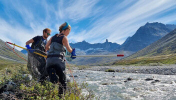
Three researchers in Vernier: Aurèle Pulfer, Marco Vieira Ruas and Emmanuelle Agustoni. Alain Herzog/EPFL Researchers have studied Vernier, a city in the canton of Geneva, as the pilot site for an interactive map that explores our relationship with the built and natural environments. "Vernier is an odd place. You pass by oil storage tanks, an Ikea, and an airport - and then suddenly you're walking by cows, the Rhône, and little boats." That's how one resident describes what he sees on his daily walking commute. He and 18 other residents took part in a study led by Atelier de la Conception de l'Espace (ALICE) and the GEOME research group within the Laboratory for Biological Geochemistry (LGB) - both part of EPFL's School of Architecture, Civil and Environmental Engineering (ENAC). Lucía Jalón Oyarzun, Emmanuelle Agustoni, Aurèle Pulfer, and Marco Vieira Ruas have developed an open-access interactive map (available in French only) that incorporates affective aspects and geographic analyses. Standard topographic maps show how to get from point A to point B. But what they don't show are how we're affected by the journey, how we perceive the environment along the route, and how all this affects our commuting choices and our physical and mental health.
TO READ THIS ARTICLE, CREATE YOUR ACCOUNT
And extend your reading, free of charge and with no commitment.
Your Benefits
- Access to all content
- Receive newsmails for news and jobs
- Post ads